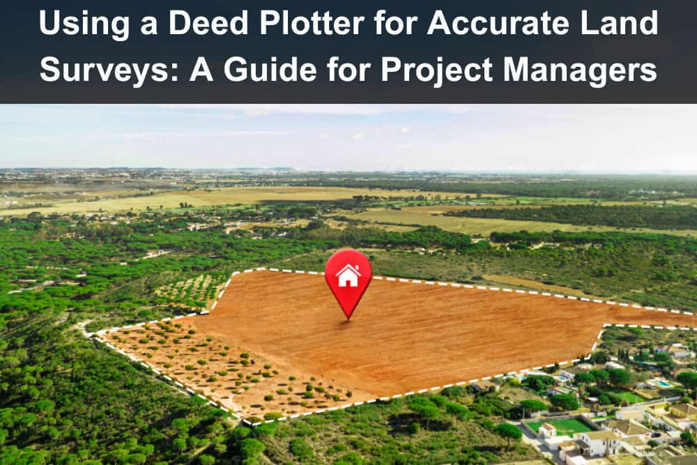
Property development, land acquisition, and real estate projects all rely on one critical foundation: knowing exactly where the boundaries are. Even the best-planned projects can face delays, conflicts, or expensive revisions without precise land data. Deed plotters are changing that. They precisely plot out property boundaries from those confusing legal deeds. Project managers in land-based industries often find this tool completely indispensable.
Ever wonder how deed plotters function? This article shows why they’re crucial and how project groups use them to fix errors, speed up work, and prevent arguments.
Understanding Deed Plotters
A deed plotter is software that takes written legal descriptions of land—usually full of directions, angles, and distances—and turns them into a visual map. Property descriptions often use ‘metes and bounds,’ an old way to define land borders by measuring physical points on the ground.
If you’ve ever read one, you know how difficult they can be to interpret. They’ll describe a line running north 43 degrees east for 120 feet, turning at a specific angle, and continuing to a marked corner. Understanding what that looks like is nearly impossible without some kind of visual aid.
That’s where a deed plotter steps in. By inputting those directions into the software, you get a clean, accurate rendering of the land. You get a clear plan from all those numbers. Imagine missing a critical error in a deed; this system catches those hidden issues, stopping you from wasting precious time and money on your building project.
Why Accurate Surveys Matter
Land surveys aren’t just about drawing lines. They iron out arguments, steer building plans, bring in the necessary funds, and follow city regulations. Whether you’re building a single house or overseeing a multi-acre development, every detail counts. If the boundary is off, even by a few feet, it can delay permitting or even trigger legal action.
Project managers count on surveyors, but solid visual tools make monitoring everything much simpler. When the map clearly shows where everything sits, decisions are made faster, miscommunications are reduced, and nobody’s stuck redoing work that could have been avoided in the first place.
The accuracy offered by deed plotters also helps teams work from the same shared view of a site. Picture this: architects, builders, and city officials. They must line up their ideas about what’s getting built and its exact spot.
How the Technology Works
At its core, a deed plotter reads direction and distance. It converts the boundary lines described in deeds into plotted points on a map. Think of it like a digital compass and ruler rolled into one. Get this part right, and you’ll have a complete shape that clearly outlines the land’s boundary lines.
A few platforms include built-in analytics. You can calculate the area automatically. You can overlay satellite imagery or other GIS data. Better systems let you easily bring in your map files or send them out, and they connect directly to property records. This isn’t just useful for surveyors. You’ll catch potential problems well before they escalate.
If the deed doesn’t close properly or the shape looks strange, it might signal an error in the description or something more serious, like an encroachment. Using a deed plotter doesn’t mean replacing surveyors. It sharpens what the pros do. It also gives everyone else, even newcomers, a solid picture of the ground they’re on.
Streamlining Land Projects
One of the biggest advantages of a deed plotter is speed. Traditionally, interpreting a deed meant doing calculations by hand or leaning heavily on a surveyor. Now, teams can input data directly and get answers in minutes instead of days. If a project manager needs to confirm whether a setback is being met or whether a boundary conflicts with a nearby easement, they can do so without waiting for a full re-survey.
In many cases, quick clarity helps keep a schedule on track. When you’re closely examining a property, deed plotters offer key help in checking all the land descriptions. Investors, brokers, and developers can review land data early on, reducing surprises after the deal closes. Look at the deed closely. You’ll catch issues before they pop up.
Common Use Cases in Real Estate and Construction
Deed plotters are useful at multiple stages of real estate and construction projects. They bring clarity to complex property details, helping professionals and clients avoid misunderstandings. From property listings to land development, these tools help streamline communication and planning.
- For Agents and Brokers: Deed plotters provide an immediate way to show potential buyers what’s included in a parcel. This helps buyers better understand access points, lot shapes, and neighboring properties.
- For Property Advertising: When ads clearly outline property boundaries, they become crystal clear and easier to interpret. This prevents frustrating mix-ups when you’re discussing the final price.
- For Construction Planning: Deed plotters serve as an important checkpoint in construction before site work begins. Engineers and architects need precise property lines before they can sketch a site layout.
- To Avoid Regulation Issues: If a building ends up too close to a boundary, even unintentionally, it could violate local regulations. Fixing that after the fact is never easy or cheap.
- For Land Developers: Deed plotting makes large planning jobs smoother and more efficient. When managing dozens or hundreds of parcels, being able to quickly compare sizes and configurations across multiple lots makes planning more manageable.
- To Replace Flashy but Useless Tools: Forget about tools that just look good; deed plotters actually pull their weight. They’re built for clarity, not just presentation.
Choosing the Right Software
Not all deed plotters offer the same experience. Some are basic and designed for personal use. Others are full-featured, built for professionals who manage multiple sites or large portfolios. Picking the best software depends on your team’s top priorities. It all comes down to how easy it is for people to use. A system that’s powerful but difficult to learn will slow people down.
On the other hand, one that’s intuitive and provides clear instructions lets teams get up to speed quickly. You should figure out if this software can actually talk to your other programs. If your organization already uses GIS tools or a project management platform, being able to import or export mapping data can save time.
Good help after the sale counts. A platform that offers helpful onboarding and responsive service is more likely to be adopted across your team. As people grow comfortable, errors vanish. Work speeds up, and everyone collaborates more closely.
The Role of Visuals in Reducing Disputes
One often-overlooked benefit of deed plotters is their role in conflict prevention. Misunderstandings about property lines can cause tension between neighbors or between clients and contractors. Having a visual reference changes that dynamic.
Instead of relying on verbal explanations or complicated paperwork, teams can point to a plotted map and say, “Here’s what we’re working with.” That transparency can smooth over a lot of potential friction.
In legal matters, that same visual clarity helps create a defensible record. If disputes arise, having well-documented, clearly plotted boundaries can strengthen a case or support mediation.
Where the Industry Is Headed
Land surveying is going through major changes. What used to require manual tools and lots of time is now increasingly digital and automated. Deed plotters represent a big part of that shift. But the future promises even more.
See how deed plotters are now linking with drone mapping tools? With aerial imaging, surveys can be updated in real time. Augmented reality may follow, allowing users to “see” property lines through their phones or AR headsets while walking a site.
You won’t see classic land surveying vanish completely. But imagine getting your property lines mapped out much quicker, for less money, and with fewer hoops to jump through. Imagine seeing and using all that survey data yourself. Soon, you, as a project manager, a property owner, or even a curious citizen, will access this information, not just the licensed experts.
Conclusion
Deed plotters have transformed how we approach land data. They make the complex understandable. Imagine your team making decisions quickly, fully trusting the facts. They’ll save precious time and sidestep big problems. For project managers, the ability to visualize land boundaries early and often is a major advantage, especially when projects are moving fast and margins are tight.
Suggested articles:
- Strategies to Streamline Construction Projects for Maximum Efficiency
- The Benefits of Project Management in Construction for SMBs
- Organizing Equipment for Improved Workflow on Construction Sites
Daniel Raymond, a project manager with over 20 years of experience, is the former CEO of a successful software company called Websystems. With a strong background in managing complex projects, he applied his expertise to develop AceProject.com and Bridge24.com, innovative project management tools designed to streamline processes and improve productivity. Throughout his career, Daniel has consistently demonstrated a commitment to excellence and a passion for empowering teams to achieve their goals.