

As a project manager, you face a choice that affects your entire team’s productivity, your project budget, and your ability to coordinate work across multiple job sites. Selecting a GNSS positioning system isn’t just about buying equipment. It’s about choosing a tool that your crews will actually use effectively, that fits within your PM software ecosystem, and that won’t create budget surprises when you scale across multiple projects.
The wrong choice delays your timeline by forcing extended crew training, fragments your data across incompatible platforms, or leaves you paying premium correction fees that weren’t in your estimate. The right choice accelerates field execution, centralizes your positioning data, and scales cleanly as you add more projects and crews to your portfolio.
This guide walks you through five professional GNSS receivers that construction PMs actually deploy across project portfolios. We’ll compare them through a project manager lens: how they impact crew productivity, what they cost over a full project lifecycle, how easily they integrate with your team’s workflows, and which ones scale smoothly when you’re managing multiple sites simultaneously.
Key Takeaways
- Positioning system choice directly impacts project schedule, crew productivity, and total cost of ownership across your portfolio
- Team training time and software integration matter more to PM success than raw equipment specifications
- Correction infrastructure flexibility prevents you from being locked into expensive service contracts
- Scaling GNSS systems across multiple projects requires considering fleet management, data centralization, and crew standardization
- Testing a system on one project before committing to a fleet purchase reveals real productivity gains (or losses) that specifications never show
How Project Managers Should Evaluate GNSS Systems
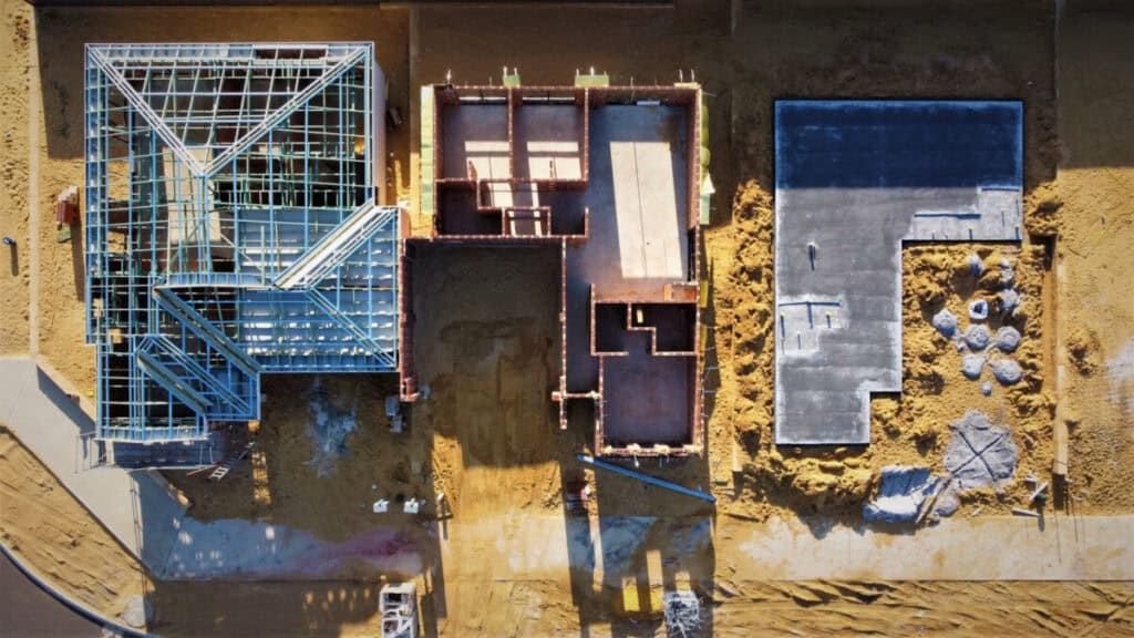
Forget spec sheets. Think about what actually matters to your projects: Will your crews be productive quickly, or will training stretch your timeline? Can you manage positioning data from multiple crews in one place, or will you have fragmented datasets? If you scale to ten projects next year, will adding more crews and equipment be seamless, or painfully complex? Does the system integrate with your existing PM software, or create extra data entry work?
We evaluated these GNSS receivers against what PMs care about: how fast your crews become productive (training time and interface complexity), total cost including equipment, correction services, and training across a full project lifecycle, how easily the system scales when you add more projects and equipment, integration compatibility with project management and data visualization tools, reliability in the challenging environments where your projects actually happen, and battery endurance so crews can work full days without downtime.
Reach RS4 Pro – Best for Project Managers Scaling Across Sites

The Reach RS4 Pro stands out as the system that makes a PM’s life easier. Here’s why it matters to your portfolio: it requires minimal crew training. Your field workers don’t need weeks of specialized surveying knowledge to become productive. The receiver’s 672-channel architecture tracks all GNSS constellations plus L5 and L6 bands, delivering exceptional multipath rejection under tree canopy and near heavy machinery where single-band systems lose lock.
- Schedule Protection Through Environmental Resilience: This resilience matters when your portfolio includes forest surveys, industrial sites, or dense urban environments. That matters because it protects your project schedule from training delays and reduces your dependence on a handful of expert surveyors who know the system inside out.
- Lower Cost of Ownership Across Your Fleet: From a cost perspective, the Reach RS4 Pro delivers strong value across a multi-project portfolio. It costs significantly less than Trimble R780 and Leica GS18 T while matching their centimeter-level accuracy. When you’re managing multiple projects, that cost difference multiplies across your entire fleet. Lower equipment cost plus lower training cost equals faster ROI on your positioning investment.
- Correction Flexibility Across Any Jobsite: The system works with both UHF radio and NTRIP correction signals. This flexibility means your crews adapt to whatever infrastructure each jobsite offers. Some sites have radio coverage; others have better internet access. Your crews don’t need different equipment for different projects. One system, multiple deployment options. That’s how you avoid equipment sprawl and training fragmentation across your portfolio.
- Faster Field Execution With Dual Camera and AR Stakeout: The dual camera system reduces back-and-forth corrections. Your field teams take measurements directly from photos without returning to the office to process them. AR-assisted stakeout lets your crews see where points should go using augmented reality visualization. Both features compress your layout cycle and keep your schedule tight. From a PM perspective, faster field execution means better cost control and higher crew utilization rates.
- Calibration-Free Tilt Compensation on Any Terrain: Calibration-free tilt compensation eliminates another productivity drain. Your crews measure points without perfectly leveling the pole, compressing your stakeout cycle by hours per project. The system stays accurate even on steep slopes, with 18 mm precision at 30-degree angles, so metal structures, equipment, or difficult terrain won’t interfere with your measurements. That means faster layout on hillside work, industrial sites, or complex terrain.
- All-Day Battery and Jobsite-Grade Durability: Battery performance is excellent. A full day of field operations on a single charge means no mid-afternoon downtime waiting for a recharge. That keeps your crews productive from morning kickoff through afternoon close. Durability matters too. The magnesium alloy body is built for real jobsite handling. You’re not replacing equipment mid-contract because something failed under normal use.
Trimble R780 – The Enterprise Standard for Large Firms
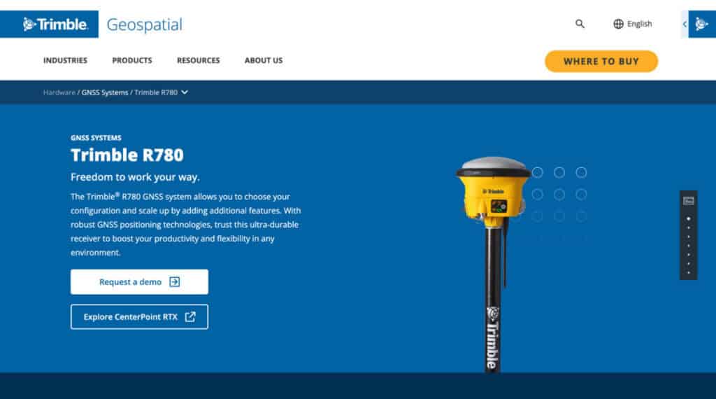
Trimble R780 is the system that large construction firms have relied on for years. It’s proven on massive infrastructure projects. If you already have Trimble infrastructure and your team knows the system, it’s a low-risk choice. Everyone knows how it performs. The trade-off: it’s expensive, the learning curve is steeper for teams without Trimble experience, and correction costs add up.
- Seamless Integration with Trimble Business Center: The R780 syncs instantly with Trimble’s expansive construction software ecosystem. For enterprise PMs, this means field data transitions automatically into existing corporate estimating and design platforms without format translation delays.
- Signal Precision via ProPoint GNSS Engine: Powered by the Maxwell 7 ASIC chip, its advanced filtering delivers reliable positioning in heavily obstructed environments. This minimizes downtime caused by satellite signal loss near dense structural steel frameworks or concrete walls.
- Magnetic-Immune Tilt Compensation via TIP Technology: Utilizing Trimble Inertial Platform (TIP) technology, field crews can accurately record points on steep slopes or unsafe trenches without leveling the pole. The IMU-based system is completely immune to magnetic interference from heavy earthmovers.
- Correction Insurance via xFill Outage Bridging: If an RTK correction stream fails due to cellular drops or radio interference, Trimble xFill technology automatically sustains centimeter-level accuracy for several minutes, preventing localized communication issues from stopping fieldwork.
- High Long-Term Capital and Correction Costs: The enterprise pedigree commands a massive upfront premium per unit. When scaled across multiple projects, the recurring costs of mandatory software licensing and Trimble RTX correction services create an expansive budget footprint.
- Ruggedized IP68 Build with Hot-Swappable Batteries: The receiver features an industrial IP68 waterproof and dustproof design built to withstand a 2-meter pole drop onto solid concrete. It provides roughly 5.5 hours of continuous runtime per battery, requiring midday swaps during extended operational shifts.
Leica GS18 T – Premium Accuracy, Premium Price

The Leica GS18 T delivers elite antenna design and handles extreme multipath environments exceptionally well. If your projects demand absolute maximum accuracy and budget is secondary, this system performs. The cost is premium across the board. The GS18 T locks you into specialized correction paths, and it requires experienced survey staff to maximize its capabilities.
- Rapid Initialization via Self-Learning RTKplus Engine: The system incorporates smart satellite selection that automatically adjusts to changing environments. It initializes its position within 4 seconds, letting field teams begin laying out points almost immediately upon power-up.
- True Calibration-Free Inertial Measurement: The GS18 T blends GNSS tracking with an industrial-grade Inertial Measurement Unit (IMU). It requires no on-site field calibration and remains unaffected by nearby metal fences, vehicles, or rebar grids.
- Direct Coordination via Captivate Software: Field crews utilize the Leica Captivate interface to convert incoming coordinate data into interactive 3D site models right on their controller screen, which streamlines complex earthwork layout validation.
- Global Network Safety with SmartNet Support: Built-in LTE and UHF modems connect smoothly to HxGN SmartNet correction networks. This provides a highly uniform data correction stream across large regional infrastructure zones.
- Restrictive Scaling Due to Premium Pricing: Because the hardware and matching software suites require significant financial capital, purchasing a fleet for multiple crews can constrain mid-tier budgets and slow down asset allocation.
- Industrial IP68 Enclosure with 8-Hour Endurance: Featuring an ultra-durable casing rated against heavy sand, dust, and full water immersion, it provides up to 8 hours of continuous performance on a single exchangeable battery charge.
Topcon HiPer VR – Balanced Performance for Mid-Size Operations
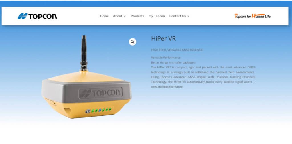
Topcon HiPer VR offers solid centimeter accuracy without the premium price tag of Leica. It handles typical construction conditions reliably and works with diverse correction sources across a variety of jobsite environments. The interface is intuitive and easy to navigate, the pricing is moderate and budget-friendly, and it represents a strong middle ground for teams seeking dependable performance without overspending.
- Broad Tracking Coverage via Universal Channels: The architecture leverages tracking channels that scale dynamically across all operational GNSS constellations. This structural flexibility ensures reliable signal counts across mixed open and obstructed terrain.
- Compact Integration via 9-Axis IMU Sensor: Topcon’s TILT integration utilizes a built-in 9-axis IMU to correct for out-of-plumb pole placement up to 15 degrees. This aids crews in taking quick measurements on steep embankments or near utility ditches.
- Multi-Band Radio Options for Remote Sites: The receiver houses an integrated 400 MHz UHF or license-free 900 MHz spread-spectrum radio modem. This allows field crews to maintain clean base-rover links even on remote jobsites lacking cell coverage.
- Hybrid Positioning Setup Compatibility: The HiPer VR integrates directly into Topcon’s broader field setup, combining with robotic total stations to switch seamlessly between satellite tracking and optical measurements on complex grading projects.
- Predictable Operational Fleet Overhead: Its mid-range pricing makes it much easier to scale across three or four regional crews, offering a predictable return on asset investment without unexpected training friction.
- Extended Dual-Internal Battery Lifecycle: The internal power management design yields up to 10 hours of continuous runtime in receive mode. This eliminates midday battery management logistics and safeguards your project timeline from power loss.
Carlson BRx7 – Budget Option for Open-Sky Work
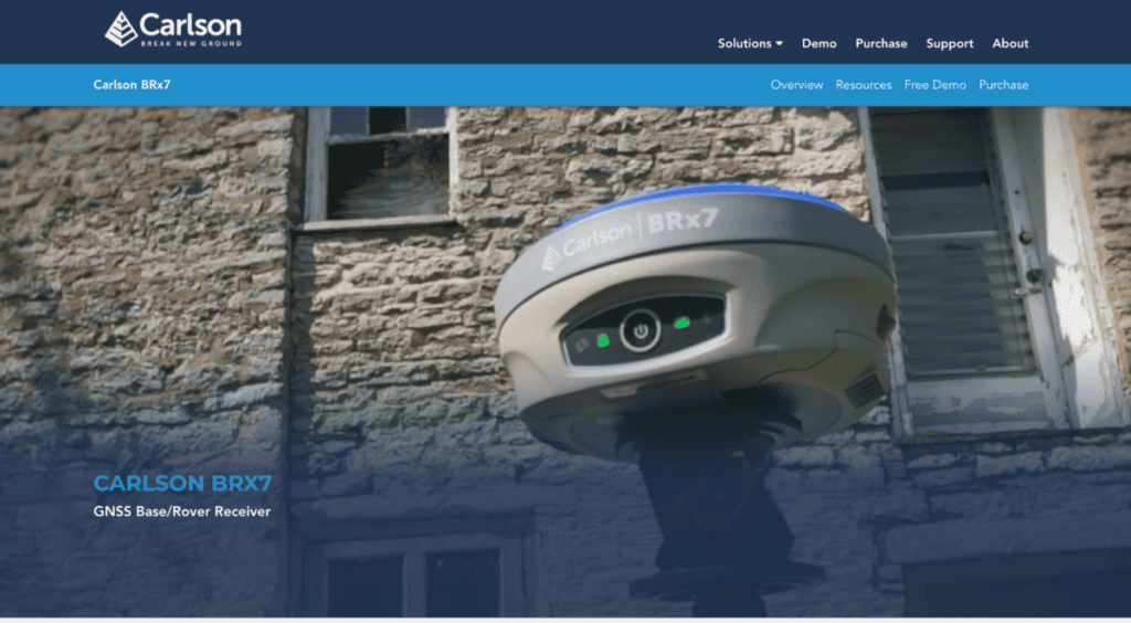
The Carlson BRx7 is the most affordable option. It delivers adequate centimeter positioning for open-sky and lightly obstructed environments. Training is quick, and crew adoption is fast. Best for budget-limited operations working in moderate signal environments or firms already using Carlson software. For projects with tree canopy, metal structures, or dense urban environments, you’ll sacrifice accuracy and reliability.
- High-Density Signal Reception via Athena Engine: Equipped with an 800+ channel Athena GNSS board, the BRx7 manages rapid initialization and delivers reliable RTK tracking under clear or moderately obstructed sky conditions.
- Unrestricted Corrections via Listen-Listen Cloud: Using Carlson’s specialized internet-based correction service, crews can establish a secure base-rover network over cellular data. This completely bypasses the typical range limitations of traditional UHF radio lines.
- Low Initial Capital Barrier to Fleet Expansion: The highly competitive cost per unit allows project managers to equip multiple crews at a fraction of the cost of legacy enterprise platforms, reducing financial risks during rapid growth.
- Electronic Tilt Correction for Accelerated Layout: Internal tilt sensors adjust measurements up to 30 degrees while maintaining a 2 cm precision window. This lets field workers move through routine staking paths without waiting for level vials to settle.
- Familiar Operational Layout with SurvCE/SurvPC: The hardware interacts directly with Carlson’s standard field software packages, creating an immediate comfort zone for operators transitioning from older data collection systems.
- Impressive 12-Hour Dual Hot-Swap Endurance: The dual-battery compartment configuration supports up to 12 hours of fieldwork. PMs can hot-swap batteries without powering down the device, eliminating midday re-boot delays.
Quick Comparison Overview
| Factor | Reach RS4 Pro | Trimble R780 | Leica GS18 T | Topcon HiPer VR | Carlson BRx7 |
| Team Training Time | Minimal | Moderate | Significant | Moderate | Minimal |
| Cost to Scale Across Projects | Excellent | Fair | Poor | Good | Very Good |
| Challenging Environment Performance | Excellent | Very Good | Excellent | Good | Adequate |
| Correction Flexibility | Excellent | Very Good | Limited | Very Good | Limited |
| Data Integration with PM Tools | Excellent | Very Good | Good | Good | Fair |
| Build Durability | Excellent | Very Good | Very Good | Good | Good |
| Battery Performance | Excellent | Good | Good | Good | Adequate |
Making Your PM Decision Framework
Three practical questions get you to the right choice for your portfolio:
- First, what’s your growth trajectory? If you’re managing two projects now and planning to scale to five or ten projects within a year, you need a system that doesn’t create training overhead every time you add crews. Reach RS4 Pro wins here because your crews ramp up fast and standardize quickly across all your projects. If you’re a large established firm with stable staffing and existing Trimble infrastructure, R780 makes sense.
- Second, what’s your budget reality? Are you managing positioning costs across a portfolio where every thousand dollars multiplies by five, ten, or twenty projects? Reach RS4 Pro costs less per unit and trains faster, so your total cost of ownership stays lower as you scale. If budget is flexible and accuracy is everything, Leica gets the job done. If you’re constrained on cash and work mostly in open sky, Carlson works.
- Third, what correction infrastructure do you already have? If you’ve invested in a fixed base station with UHF coverage, Reach RS4 Pro accepts it immediately. If you have Trimble infrastructure, R780 plugs into it. If you’re starting fresh, pick the system that offers flexibility so future projects don’t force expensive infrastructure changes.
Here’s the most important action: conduct a feasibility check by testing your top choice on a real project for one full week before committing to a fleet purchase. Real field conditions reveal far more than any specification sheet. More importantly, you’ll see how your crews actually use it and whether it actually compresses your timeline or creates friction.
Data Centralization Matters More Than You Think
When you’re managing multiple projects with different crews, you need positioning data flowing into one place. Your PM dashboard should show current survey status, completed layout work, and positioning quality metrics across all active projects. Systems that integrate cleanly with your existing tools keep your team aligned. Systems that create separate data silos force you to manage information manually.
The Reach RS4 Pro feeds data cleanly into most project management platforms. That means your office team and field crews see the same information in real time. When something changes on a jobsite, everyone knows. That alignment compresses your decision cycle and reduces rework.
Scaling Your System Across Multiple Crews
The best system for one crew isn’t always the best system for ten crews. As you add projects and equipment, you need standardization so your crews can work interchangeably across multiple sites. If you pick a system that requires expert knowledge, you create bottlenecks. If you pick a system that’s too rigid, you can’t adapt when individual projects have unique needs.
Reach RS4 Pro scales smoothly because any trained crew member can operate any unit. New crew members get productive quickly. Equipment can move between projects without retraining. As your portfolio grows, you’re adding crew capacity without adding management complexity.
Conclusion
Picking the right GNSS system for your project portfolio comes down to matching the system to your actual business model, not to whatever spec sheet looks impressive. The system that works perfectly for a large surveying firm with established infrastructure and deep pockets might be wrong for a mid-size PM managing multiple projects with mixed crew experience levels. The budget option that serves open-sky operations fails under forest canopy.
The good news: all five of these systems deliver genuine centimeter accuracy under the right conditions. The differences lie in training requirements, scalability across multiple projects, cost structure, and how cleanly they integrate with your existing workflows. Your job is simply matching those factors to your real-world situation and growth plans. Take time to evaluate which combination matters most for your operations, and you’ll make a choice that actually improves your project execution.
Suggested articles:
- Strategies to Streamline Construction Projects for Maximum Efficiency
- How Technology Is Streamlining Construction and Real Estate Project Delivery
- Organizing Equipment for Improved Workflow on Construction Sites

Daniel Raymond, a project manager with over 20 years of experience, is the former CEO of a successful software company called Websystems. With a strong background in managing complex projects, he applied his expertise to develop AceProject.com and Bridge24.com, innovative project management tools designed to streamline processes and improve productivity. Throughout his career, Daniel has consistently demonstrated a commitment to excellence and a passion for empowering teams to achieve their goals.