
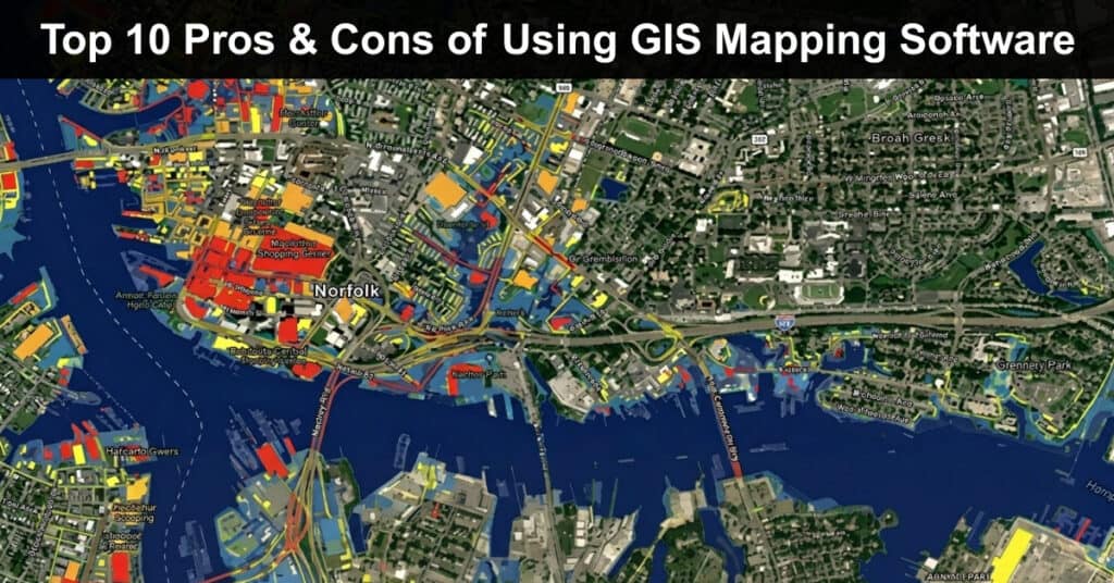
Geographic Information System (GIS) mapping software has changed how organizations analyze and interpret spatial data, turning raw coordinates into insights that guide real decisions. From urban planning to disaster response, GIS applications now span nearly every industry that depends on location. This technology lets teams visualize geographic patterns that would otherwise stay buried in spreadsheets.
Despite its strengths, Geographic Information Systems (GIS) mapping software brings real challenges, including cost, training time, and data security concerns that organizations cannot ignore. Understanding both sides before adopting GIS mapping software helps teams set realistic expectations and budget accordingly. This guide breaks down the top pros and cons of using GIS mapping software so you can decide if it fits your organization:
The 5 Pros or Advantages of Using GIS Mapping Software
GIS mapping software offers several advantages that can meaningfully improve the speed and accuracy of spatial data analysis across an organization. The benefits below extend well beyond simple map creation and now include automated insights powered by artificial intelligence. Understanding these five advantages helps teams see where GIS delivers the most practical return on investment.
Advantage #1: Enhanced Data Visualization
GIS mapping software converts raw location data into interactive maps and charts that reveal patterns no spreadsheet could show on its own. Modern platforms now layer satellite imagery, demographic data, and real-time sensor feeds into a single visual interface. This makes it far easier for non-technical stakeholders to understand spatial relationships and act on them quickly. The result is faster, more confident decision-making across departments.
This visualization advantage shows up clearly across several practical applications:
- Visual Representation of Complex Data: GIS transforms layered datasets, such as traffic counts, zoning boundaries, and population density, into a single map view that is far easier to interpret than rows of numbers.
- Easy Identification of Patterns and Trends: Color-coded heat maps and clustering tools let analysts spot trends like rising congestion or shifting demographics at a glance rather than digging through tables.
- Improved Decision Making Based on Visual Insights: Decision makers who can see spatial patterns directly tend to act faster and with more confidence than those relying on text-based reports alone.
Real-Life Example: Urban planners in New York City use GIS software to map traffic congestion patterns and identify high-traffic corridors across multiple boroughs. This visual approach helps the department target specific intersections for signal timing changes, resulting in measurably smoother commutes for residents and reduced idle time for commercial delivery vehicles throughout the city.
Advantage #2: Improved Accuracy and Efficiency
GIS mapping software has become significantly more accurate as platforms integrate automated data collection and machine learning-driven error correction. According to LightBox, artificial intelligence is now reshaping how organizations process geospatial data, allowing teams to extract meaningful insights from datasets that would have taken weeks to review manually. AI fundamentally reshapes how organizations analyze geospatial data by processing vast datasets in real time and extracting meaningful insights from location intelligence. This shift toward automation reduces the manual effort required for quality control.
These efficiency gains tend to concentrate around a few specific operational improvements:
- Automated Data Collection and Analysis: GPS-enabled field devices and IoT sensors feed location data directly into GIS platforms, removing the need for manual entry and reducing transcription mistakes.
- Reduction in Human Error: Built-in validation rules flag inconsistent coordinates or mismatched attribute data before they make it into a final report or map layer.
- Efficient Management of Large Datasets: Cloud-based GIS platforms can now process high-resolution satellite imagery and large point cloud datasets without requiring expensive local hardware upgrades.
Real-Life Example: Environmental agencies use GIS to track wildlife populations across large protected areas spanning multiple states or countries. The software’s precision in mapping animal movement and habitat boundaries supports conservation planning, helping agencies allocate patrol resources and identify poaching risk zones with far greater confidence than manual survey methods ever allowed field teams.
Advantage #3: Cost Savings
GIS mapping software can reduce long-term operational costs by streamlining field work, cutting redundant data collection, and improving resource allocation across teams. Cloud-based subscription models have also lowered the barrier to entry, since organizations no longer need to maintain expensive on-premise servers. Over time, these efficiencies tend to offset the initial investment, particularly for organizations managing large geographic territories.
Several specific cost categories tend to see the most noticeable improvement after adoption:
- Streamlined Operations and Reduced Manual Labor: Automating route planning and field data capture cuts the hours staff spend on manual surveys and paperwork-based tracking.
- Better Resource Management: Spatial analysis helps organizations identify underused assets or overlapping service areas, allowing them to reallocate staff and equipment more efficiently.
- Lowered Costs in Field Data Collection: Mobile GIS apps let field crews capture and sync data instantly, cutting the need for follow-up trips or paper-based corrections.
Real-Life Example: Utility companies use GIS to map and maintain infrastructure like pipelines, electrical lines, and substations spread across entire service regions. By tracking the condition of assets geographically, crews can schedule preventive maintenance more efficiently, reducing unplanned outages and cutting emergency repair costs that typically run far higher than routine scheduled upkeep.
Advantage #4: Enhanced Collaboration
GIS mapping software gives teams and external stakeholders a shared visual platform for spatial data, which reduces miscommunication and version control problems common with static maps or spreadsheets. Cloud-based GIS tools now support real-time collaboration, meaning multiple users can update the same dataset simultaneously from different locations. This shift has made cross-departmental coordination considerably faster than it was with older desktop-only systems.
This kind of shared access tends to improve collaboration in a few measurable ways:
- Centralized Data Repository: Storing spatial data in one cloud-based system prevents the version conflicts that happen when teams email spreadsheets or shapefiles back and forth.
- Easy Access to Updated Information: Authorized users can view live updates the moment new field data is captured, rather than waiting for a manual refresh or new file upload.
- Improved Communication and Coordination: Shared dashboards let teams annotate maps directly, replacing lengthy email threads with visual notes everyone can see in context.
Real-Life Example: Emergency response teams use GIS during natural disasters to share real-time data on affected areas, evacuation routes, and shelter capacity. This shared platform allows fire, police, and medical teams to coordinate efforts from a single map view, improving response times and helping commanders direct aid where it is needed most urgently and quickly.
Advantage #5: Better Risk Management
GIS mapping software gives risk managers a spatial lens for identifying hazards that would be difficult to spot using tabular data alone. Insurance, utility, and government agencies increasingly rely on predictive modeling layered onto geographic data to forecast where risks are most likely to materialize. This proactive approach helps organizations act before a problem escalates rather than only responding after damage occurs.
A few specific risk management functions stand out as particularly valuable in practice:
- Risk Assessment and Mitigation Planning: GIS overlays hazard data, such as flood plains or wildfire zones, onto infrastructure maps to highlight where mitigation spending should be prioritized.
- Identification of Vulnerable Areas: Spatial clustering tools reveal which neighborhoods or assets face compounding risks, such as overlapping flood and earthquake exposure.
- Data Driven Decision Making for Risk Reduction: Historical hazard data combined with current conditions allows organizations to model multiple risk scenarios before committing resources.
Real-Life Example: Insurance companies use GIS to assess natural disaster risk by analyzing flood zones, earthquake-prone areas, and wildfire corridors across entire portfolios of insured properties. This geographic risk data allows underwriters to set premiums more accurately, helping insurers avoid the heavy losses that come from underpricing policies in high-risk regions nationwide.
The 5 Cons or Disadvantages of Using GIS Mapping Software
GIS mapping software comes with real challenges that organizations need to plan for before committing budget and staff time to implementation. These disadvantages range from upfront cost to ongoing data security concerns that have become more pressing as GIS systems move to the cloud. Recognizing these five challenges early helps teams build a more realistic adoption plan.
Disadvantage #1: High Initial Cost
The upfront investment required for GIS mapping software remains a real barrier, particularly for smaller organizations and nonprofits operating on tight budgets. Even with the rise of cloud subscription pricing, licensing fees, hardware upgrades, and staff training can add up quickly. Industry research shows the broader GIS software market reaching well into the billions, reflecting how much organizations continue to invest despite the cost concerns.
These costs tend to break down across a few predictable categories that buyers should budget for:
- High Purchase and Licensing Fees: Enterprise platforms like ArcGIS often charge per-seat licensing that scales quickly once an organization adds more analysts or field staff.
- Costs Associated With Hardware and Infrastructure: Processing large raster datasets or 3D models may still require upgraded workstations even when the software itself runs in the cloud.
- Training Expenses for Staff: Formal GIS certification programs and ongoing skill development represent a recurring cost beyond the software license itself.
Real-Life Example: A small municipal government may struggle to justify GIS software costs against a tight annual budget already stretched across roads, schools, and emergency services. Staff often delay the purchase for years, relying on outdated paper maps that slow down permitting and zoning decisions while neighboring municipalities move ahead with faster, data-driven processes.
Resolution: Organizations facing this barrier can explore federal or state infrastructure grants earmarked specifically for digital modernization, many of which directly cover GIS adoption costs. Open-source platforms like QGIS offer a no-cost starting point, and phased rollouts that begin with one department let smaller governments spread expenses across multiple budget cycles comfortably.
Disadvantage #2: Steep Learning Curve
GIS mapping software still demands a meaningful amount of specialized training, even as vendors work to simplify their interfaces for non-technical users. New users often need months of hands-on practice before they can build maps or run spatial queries independently. This learning curve becomes a real bottleneck for organizations that need to deploy GIS quickly across multiple departments.
The difficulty tends to surface in a few consistent areas during onboarding:
- Complex Interface and Functionalities: Full-featured platforms pack dozens of tools and menus that can overwhelm users coming from simpler mapping apps or spreadsheets.
- Need for Ongoing Training and Skill Development: Spatial analysis techniques like geoprocessing and coordinate system management require continued practice beyond a single onboarding session.
- Time Consuming Initial Setup and Data Input: Importing legacy data from incompatible formats often takes far longer than organizations initially anticipate during rollout.
Real-Life Example: A new employee at an environmental consultancy firm may take several months to use GIS software proficiently across the full range of analysis tools required. During that ramp-up period, senior staff often need to review the new hire’s work closely, which slows down project timelines and adds an unplanned mentorship burden to already busy teams.
Resolution: Companies can shorten this ramp-up period by pairing new hires with structured online courses from providers like Esri Academy alongside hands-on mentorship from experienced GIS analysts already on staff. Building an internal library of templated workflows also lets new staff follow proven steps rather than learning every single tool from scratch.
Disadvantage #3: Data Privacy and Security Concerns
Handling sensitive geographic data introduces privacy and security risks that have grown more serious as GIS systems move to cloud infrastructure. Cybercriminals may steal, leak, change, or delete GIS data for nefarious purposes, retaliation, or sabotage using their devices, access privileges, or credentials, and the consequences of such a breach can be severe. Spatial data can also reveal physical infrastructure layouts that bad actors could exploit if security controls are weak.
These risks tend to cluster around a few specific vulnerabilities organizations need to address directly:
- Potential for Data Breaches: Cloud-hosted GIS platforms expand the attack surface compared to older on-premise systems, making strong access controls essential.
- Compliance With Data Protection Regulations: Laws like GDPR and CCPA require organizations to manage consent and data handling carefully when location data ties back to individuals.
- Need for Robust Security Measures: Geospatial data reveals the layout and vulnerabilities of physical infrastructure, including government facilities, transportation networks, and energy grids, which raises the stakes for proper encryption.
Real-Life Example: A healthcare organization using GIS to map patient data must ensure that all information stays secure and fully compliant with data protection laws across every state it operates. A single unsecured database export could expose sensitive patient addresses and treatment locations, creating both legal liability and a serious breach of patient trust.
Resolution: Strong encryption for data at rest and in transit, combined with role-based access controls and multi-factor authentication, addresses most of these vulnerabilities directly and consistently. Regular security audits and staff training on phishing risks further reduce the chance that a single compromised credential exposes an entire spatial database to outside attackers.
Disadvantage #4: Dependency on Data Quality
GIS mapping software is only as reliable as the data feeding it, and outdated or inaccurate source data can quietly undermine every map and analysis built on top of it. Organizations sometimes overestimate how current their underlying datasets actually are, leading to confident-looking maps built on stale information. This dependency makes data governance just as important as the software itself.
A few specific data quality issues tend to surface most often in practice:
- Inaccurate or Outdated Data Can Lead to Erroneous Conclusions: Census figures, zoning boundaries, or infrastructure records that go unrefreshed for years can quietly skew planning decisions.
- High Costs Associated With Data Acquisition and Verification: Sourcing high-resolution satellite imagery or commissioning new surveys to verify existing data adds ongoing expense beyond the software license.
- Challenges in Integrating Diverse Data Sources: Combining data from drones, field surveys, and third-party vendors often requires manual cleanup before it aligns properly on a single map.
Real-Life Example: A city planning department using outdated census data may make flawed decisions regarding infrastructure development across growing neighborhoods that have shifted significantly in population. New schools or transit routes planned around population figures that are years out of date can leave entire neighborhoods underserved while resources go to areas that no longer need them.
Resolution: Establishing a regular data refresh schedule, ideally tied to new census releases or annual municipal surveys, keeps planning decisions grounded in current conditions. Cross-referencing multiple data sources before finalizing a map layer also catches inconsistencies early, before they influence costly infrastructure decisions that are difficult to reverse later.
Disadvantage #5: Technical Issues and Maintenance
GIS mapping software, like any complex enterprise system, can run into bugs, compatibility problems, and performance issues that require dedicated technical support to resolve. Organizations using older desktop-based platforms sometimes struggle most, since large datasets can slow rendering and cause crashes during peak usage. Even cloud-based tools require ongoing maintenance to stay compatible with evolving data formats and integrations.
These technical challenges tend to show up most often in a few predictable situations:
- Software Bugs and Glitches: Frequent updates can occasionally introduce new bugs, particularly in plugins or third-party extensions layered onto the core platform.
- Compatibility Issues With Other Systems: Integrating GIS with existing CRM, ERP, or asset management software often requires custom development work that smaller IT teams may struggle to support.
- Need for Ongoing Technical Support and Updates: Large raster files and point cloud datasets can strain hardware resources, especially on platforms not optimized for cloud processing.
Real-Life Example: An agricultural firm using GIS to manage crop data might experience software crashes during peak planting or harvest seasons when system demand is highest. Losing access during these critical windows can delay decisions about irrigation or pest control, directly affecting yield at the exact moment timing matters most for the entire growing season.
Resolution: Scheduling major software updates outside peak operational periods reduces the risk of disruption during these critical seasonal windows for agricultural and other time-sensitive operations. Maintaining a dedicated technical support contact, whether internal or through the vendor, along with regular system health checks, helps catch performance issues before they escalate into a full outage.
Conclusion
GIS mapping software delivers real advantages in data visualization, accuracy, collaboration, and risk management, making it a valuable tool across industries from urban planning to insurance. As artificial intelligence and cloud computing continue to reshape the technology, these benefits are becoming more accessible to organizations that once found GIS too costly or complex to adopt.
At the same time, high upfront costs, a genuine learning curve, and data security concerns deserve careful consideration before committing budget and staff time. Organizations that weigh both sides honestly, plan for training, and build strong data governance practices position themselves to get real value from GIS mapping software rather than struggling through a rushed implementation.
Suggested articles:
- The Most Powerful Mapping Software for Teams
- 7 Logistics Risks Every PM Should Anticipate
- Why Data-Driven Logistics Is the Next Competitive Edge for Growing Brands

Daniel Raymond, a project manager with over 20 years of experience, is the former CEO of a successful software company called Websystems. With a strong background in managing complex projects, he applied his expertise to develop AceProject.com and Bridge24.com, innovative project management tools designed to streamline processes and improve productivity. Throughout his career, Daniel has consistently demonstrated a commitment to excellence and a passion for empowering teams to achieve their goals.